Cathy posting:
When we started this trip we thought that one month was enough, the plan was to drive along the Wild Atlantic Way and also have a few inland stops too, well, we underestimated the size of the coast and so apart from a few jaunts inland to escape stormy weather we have stuck to the coast, we love this island and will be back next year to explore the lakes and castles of which there are many and all the towns that we’ve missed.

Pogo with the Wild Atlantic Way marker point
So last night we arrived at Blacksod, Co Mayo, a small harbour
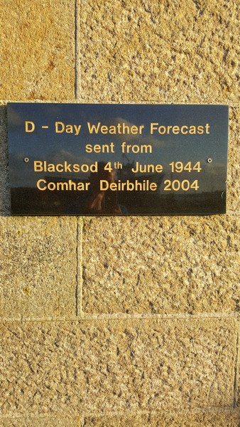
with a square lighthouse and views over to Achill island. It was at this very lighthouse that on 4th June 1944 a weather report was telephoned to London by Ted Sweeney the Blacksod Attendant Coastguard, this report stated that a cold front was expected with heavy rain and force 7 winds over the English Channel for the 5th June 1944, little did he know that operation Overlord was planned for 5th and his report that day meant delaying the D Day invasion of 150,000 Allied troops in to France until 6th and changed the course of WWII.
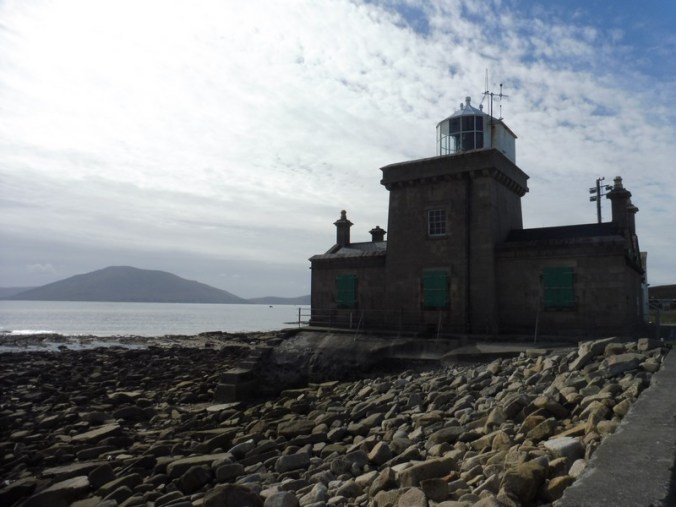
Blacksod square lighthouse made from local granite
Next morning it was a gentle stroll along the beach after viewing the placards which explained Blacksods unique history. This small port has seen much in its lifetime, also on 14th March 2017 an Irish Coastguard rescue helicopter SIKORSKY S-92 crashed with the loss of all 4 lives whilst on a rescue operation.
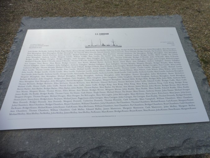
From this area between 1882-1884 thousands of families emigrated to places like Quebec, Canada and Boston, USA on 15 voyagers. James Hack Tuke, a Quaker from York England had already travelled to the USA and Canada and worked tirelessly to identify land that could be used for people in search of a better life, over 3,500 people from this part of north-west Ireland left on steam ships on his assisted emigration project, known as the Tuke fund. The assistance given was a small holding plot of land, new clothing, and a small sum of money on landing, at least one member of the family had to speak English. The placards and monument laid out in the shape of a boat.
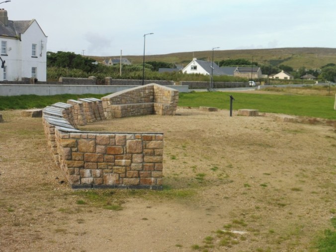
Emigration commemoration placards
It is so peaceful….


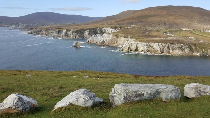
View of Achill Islands
Achill Island can be seen from this beach and that’s where we head to next, on the way we stop at the free Ballycroy Visitor Centre where we learn about the turf cutting which is and has been such an important feature in everyday life in rural Ireland, it’s a hard arduous system, the turf goes through several gruelling processes and is eventually dried out and used for fuel.

Drying turf
The mountain range which we go through is huge, peat valleys surrounded by lonesome looking mountains called Nephin Beg Range, much of it is inaccessible, I don’t think I’d like to walk the trails they look more like a wilderness and more for the stoical hiker.

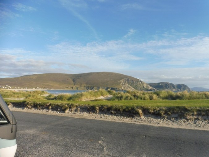
On Achill Island
Reaching Achill Island we arrive at Keel strand it’s beautiful and I’ve run out of superlatives to describe what we see each day on this trip, we park for free in front of the sand dunes and glad to see public toilets over the road for us to use and empty our loo discreetly at night, leaving it cleaner than we find it, Dave also discovered a free drinking water tap nearby, so we fill up once again.
Keel Beach, Achill Island

Keel beach
We had a good night out in the village, a lovely meal and a bit of local music with a traditional session on at 9.30pm, all the music events are at 9.30pm, everywhere! The Annexe Inn was an old pub, a bit drab inside but the warming fire, good Guinness and the music made up for its lack of decoration. Just before the music ended a huge group of hen girls arrived, where did they come from in this small place?
We had a good laugh with them and they gave us headbands to wear, Dave liked his!

Dave the hen!
Back at Pogo, Dave is amazed by the full moon and many photos later he finally crashes in to bed, we’d had a good night and it might be a slow start tomorrow.

Cathy
Useful info:
GPS Blacksod, free parking, N54.09904,W010.06191
GPS Ballycroy National Park Visitor centre, free entry, free parking, N54.02505,W009.82452
GPS Keel Beach on Achill Island, free parking, public toilets N53.97405,W010.07780
GPS Keel Beach water tap N53.974762,W010.082232

Wow. That’s some journey you’ve done. I’m even learning things from you. You’ve been to some amazing places. Enjoy x
LikeLiked by 1 person
Thanks Sue, we learn new things ourselves everyday, Ireland is fantastic and the weather has been quite good for the most part
Cathy
LikeLike
Nephinbeg sounds intriguing. Great picture again . 1st place to Dave the hen 😁😁😁
LikeLike
They swarmed him! The girls were good fun , everyone is so friendly
Cathy
LikeLike